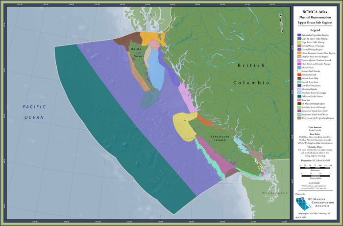
feature (id #3):
Oceanographic Regions (renamed Upper Ocean Sub Regions)

| category | physical |
| description | Upper ocean sub regions derived from expert knowledge, primary literature, satellite imagery, and oceanographic modelling. |
| atlas page | view PDF (1.8 MB) (Find in our 2010 printed atlas on page 3.) |
| metadata | view online |
| feature GIS data | download ZIP of shapefiles (27.9 MB) |
| Marxan metadata | view online |
| Marxan-ready data | Either BCMCA does not have permission to share Marxan data for this feature (see data custodians), or BCMCA does not use this feature in the analyses and so no Marxan data was generated for this feature. |
See our Glossary to learn about these terms (metadata, feature GIS data, Marxan-ready data, etc)
2 comments about this feature
comment on this feature
for data layer: Oceanographic Regions
custodian — Parks Canada: Greg MacMillan
how to access the restricted data
This feature was created from 1 raw data layer. Each data layer has a custodian and different restrictions as to which types of data BCMCA may distribute on this website. The unrestricted feature and Marxan-ready data are available to download at the map & data tab. To gain access to the restricted data, please go through the following process:
- Determine whether you are interested in the feature data or Marxan-ready data. (See the Glossary for descriptions on these data types.)
- Using the info below, make a list of the custodians you will need to contact for permission to use the data. Please note that many of the features use similar data layers and require permission from the same custodians. Also note that BCMCA does not supply the contact information for the custodians, but they can be found through web searches. Then contact each of the custodians directly, indicating:
- which features you are requesting permission to have data for
- whether you are requesting the feature data or Marxan-ready data
- When all of the required permissions have been received for a feature or set of features, please forward the email confirmations to the BCMCA data custodian at info@bcmca.ca to obtain the data.
An index of all the data custodians for ALL features is available here.

Hi there,
I noticed that the metadata for this feature says that the Area Attribute in the attribute table is in m2 and I think it must be a typo – I assume these values are km2? Just wanted to let you know there may be a typo.
Thank you!
You are correct! Area is in square kilometers. I will post again when revised metadata has been posted. Thank you!