Make informed decisions about Canada’s Pacific.
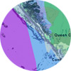
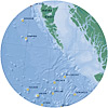
The British Columbia Marine Conservation Analysis (2006–2013) was a collaborative endeavour, creating tools to help inform decision-making for our coast.
On this website, browse or search a detailed PDF atlas and download GIS data files of over 300 ocean features, as well as view analysis results.
Also explore an interactive atlas on the Community Mapping Network.
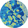
Marxan analysis
review & download