feature (id #154):
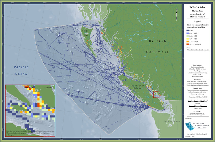
At-sea Density of Marbled Murrelet

| category | at-sea |
| description | Distribution and density of marine habitat use by Marbled Murrelet, shown as density at-sea. |
| atlas page | view PDF (3.4 MB) (Find in our 2010 printed atlas on page 103.) |
| metadata | view online |
| feature GIS data | BCMCA does not have permission to share data for this feature (see data custodians). |
| Marxan metadata | view online |
| Marxan-ready data | Either BCMCA does not have permission to share Marxan data for this feature (see data custodians), or BCMCA does not use this feature in the analyses and so no Marxan data was generated for this feature. |
See our Glossary to learn about these terms (metadata, feature GIS data, Marxan-ready data, etc)
for data layers: Southwest Vancouver Island Shelf Surveys; Trevor Channel Transects
custodian — n/a: Alan Burger
restrictions — There are restrictions set on BCMCA distributing the raw data, feature data, and Marxan-ready data.
for data layers: British Columbia Ferry Surveys; Pelagic Seabird Surveys
custodian — Environment Canada (Canadian Wildlife Service): Kathleen Moore
restrictions — There are restrictions set on BCMCA distributing the raw data.
for data layer: Marine Bird Database
custodian — Environment Canada (Canadian Wildlife Service): Doug Bertram
restrictions — There are restrictions set on BCMCA distributing the raw data, feature data, and Marxan-ready data.
for data layer: West Coast Trail Surveys
custodian — Parks Canada: Mike Collyer
restrictions — There are restrictions set on BCMCA distributing the raw data, feature data, and Marxan-ready data.
for data layer: Marbled Murrelet Surveys
custodian — n/a: Bernard Schroeder
for data layer: Laskeek Bay Surveys
custodian — Laskeek Bay Conservation Society: Lindsay Seegmiller
restrictions — There are restrictions set on BCMCA distributing the raw data, feature data, and Marxan-ready data.
how to access the restricted data
This feature was created from 8 raw data layers. Each data layer has a custodian and different restrictions as to which types of data BCMCA may distribute on this website. The unrestricted feature and Marxan-ready data are available to download at the map & data tab. To gain access to the restricted data, please go through the following process:
- Determine whether you are interested in the feature data or Marxan-ready data. (See the Glossary for descriptions on these data types.)
- Using the info below, make a list of the custodians you will need to contact for permission to use the data. Please note that many of the features use similar data layers and require permission from the same custodians. Also note that BCMCA does not supply the contact information for the custodians, but they can be found through web searches. Then contact each of the custodians directly, indicating:
- which features you are requesting permission to have data for
- whether you are requesting the feature data or Marxan-ready data
- When all of the required permissions have been received for a feature or set of features, please forward the email confirmations to the BCMCA data custodian at info@bcmca.ca to obtain the data.
An index of all the data custodians for ALL features is available here.
